COOT MOUNTAIN
Missouri Lookouts - Shannon County - Missouri Conservation Commission - 29N-3W-22
1939: "Three towers being erected in 1939 include 67-foot tower at Coot Mountain." Twenty acres were acquired by the Conservation Commission for the purpose of erecting a fire tower. (Missouri Conservation Commission Annual Report)
1940: A 68-foot steel tower with 7 x 7 foot cab erected on the 20 acre towersite. (Report of the Missouri Conservation Commission)
1942: Construction and development during 1942: 1 outbuilding. (Missouri Conservation Commission Annual Report)
1945-1946: The 'Official Manual of the State of Missouri' indicates that the towersite is owned by the Missouri Conservation Commission and is 20 acres in size.
FY 1968-69: "Overhead garage doors were hung at Coot Mountain towersite garage." (Missouri Department of Conservation Annual Report FY 1968-69)
FY1969-70: "A shower and ceramic wall tile was installed at the Coot Mountain towersite dwelling." (Annual Report of the Missouri Department of Conservation)
FY1971-72: "Coot Mountain residence received new floor covering in the kitchen and bath." (Annual Report of the Missouri Department of Conservation)
FY1977-78: "The installation of new roofs on the residence and garage at the Coot Mountain Tower Site." (Missouri Department of Conservation Annual Report)
FY1981-82: "Installed a window air conditioner at the Coot Mountain tower residence." (Missouri Department of Conservation Annual Report)

|
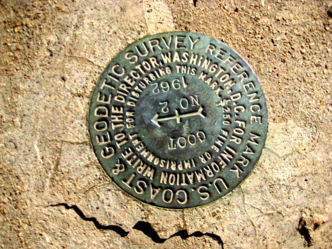
The NGS Data Sheet
|

|
STATION DESCRIPTION
DESCRIBED BY COAST AND GEODETIC SURVEY 1962 (VBM)
THE STATION IS THE CENTER OF THE BASE OF THE LOOKOUT TOWER
LOCATED ABOUT 5-1/2 MILES EAST AND 1-3/4 MILES NORTH OF
EMINENCE, ON COOT MOUNTAIN, IN THE NORTHEAST 1/4 OF SEC.
22, T. 29 N., R. 3 W., AND ON LAND OWNED BY THE STATE. THE
TOWER IS A FOUR LEGGED STEEL STRUCTURE WITH A METAL OBSERVATION
ROOM AT THE TOP AND THE OVERALL HEIGHT IS APPROXIMATELY
80 FEET.
TO REACH FROM THE JUNCTION OF STATE HIGHWAYS 19 AND 106 IN EMINENCE,
GO EASTERLY ON HIGHWAY 106 FOR 5.25 MILES TO A SIDE ROAD
LEFT. TURN LEFT AND GO NORTH ON COUNTY ROAD V FOR 1.0 MILE
TO A SIDE ROAD RIGHT. CONTINUE NORTH ON COUNTY ROAD V FOR
0.6 MILE TO A SIDE ROAD RIGHT. TURN RIGHT AND GO EASTERLY
ON A GRAVELED ROAD FOR 1.5 MILES TO THE TOP OF COOT MOUNTAIN
AND THE STATION.
|
.
|
|
No date - Courtesy: Bob Frakes
|
